Introduction
What does it do?
- Show an interactive OpenStreetMap map with Openlayers or Leaflet.
- Store coordinates in fe_users and tt_address tables and show as markers in the map.
- Show record information in popup window.
- Display gps tracks.
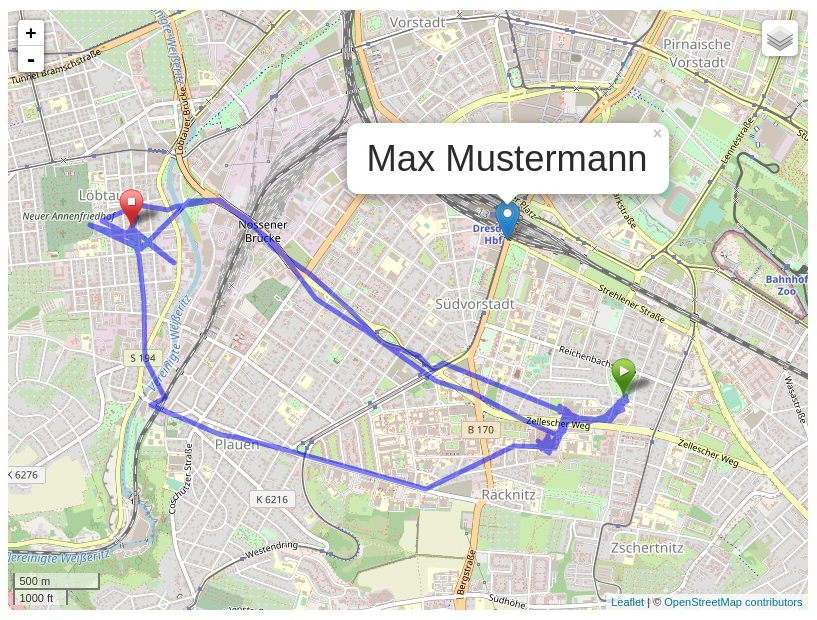
Screenshots
Frontend plugin
The example shows the output of the frontend plugin with the following settings:
- Leaflet JavaScript
- address of “Max Mustermann” as tt_address record with default marker, clickt on the marker
- GPX track with start and stop marker
Donation
This extension was only possible with the help of many other free projects.
You’re likely using one of the main map “Mapnik”, “Osmarender” or “Cyclemap” - feel free to donate to the OpenStreetMap project http://donate.openstreetmap.org/
If you are using the address search (autocomplete longitude and latitude in address records), please donate the service you use:
Geonames: http://www.geonames.org/donations.html or buy some credits there.
Nominatim: http://donate.openstreetmap.org/
And don’t forget the main components: http://typo3.org/ and http://openlayers.org/ or http://leaflet.org/