Extension Manager
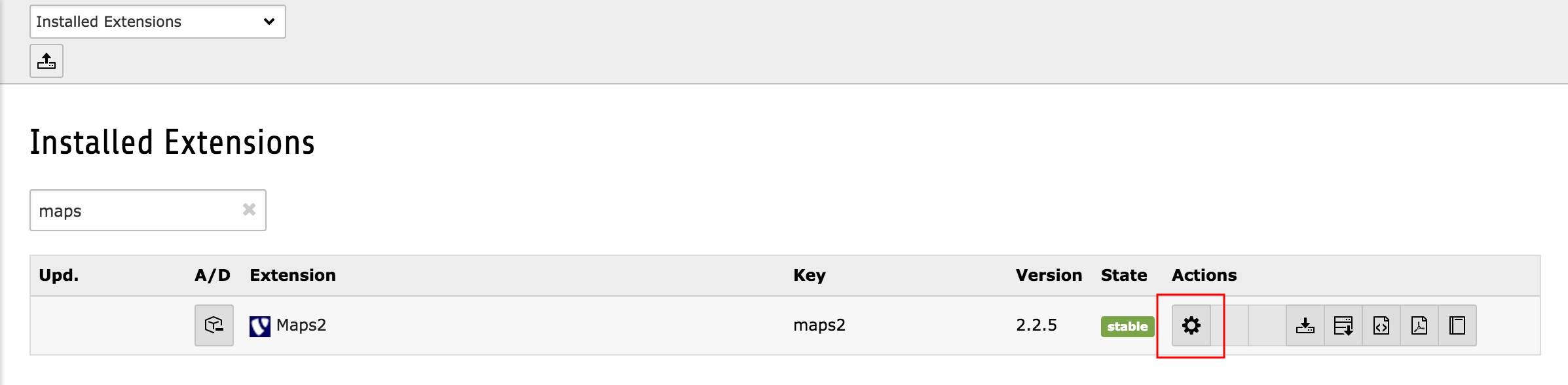
Some general settings can be configured in the Extension Manager. If you need to configure those, switch to the module “Extension Manager”, select the extension “maps2” and press on the configure-icon!
The settings are divided into several tabs and described here in detail:
Properties
| Property | Tab | Default |
|---|---|---|
| googleMapsLibrary | basic | https://maps.googleapis.com/maps/api/js?key=|&callback=initMap |
| googleMapsJavaScriptApiKey | basic | |
| googleMapsGeocodeApiKey | basic | |
| explicitAllowGoogleMaps | basic | 0 |
| defaultCountry | basic | |
| defaultLongitude | basic | 0.000000 |
| defaultLatitude | basic | 0.000000 |
| defaultRadius | basic | 250 |
| infoWindowContentTemplatePath | basic | EXT:maps2/Resources/Private/Templates/InfoWindowContent.html |
| allowMapTemplatePath | basic | EXT:maps2/Resources/Private/Templates/AllowMapForm.html |
| strokeColor | design | #FF0000 |
| strokeOpacity | design | 0.8 |
| strokeWeight | design | 2 |
| fillColor | design | #FF0000 |
| fillOpacity | design | 0.3 |
| markerIconWidth | design | 25 |
| markerIconHeight | design | 40 |
| markerIconAnchorPosX | design | 13 |
| markerIconAnchorPosY | design | 40 |
Property details
- googleMapsLibrary
- googleMapsJavaScriptApiKey
- explicitAllowGoogleMaps
- googleMapsGeocodeApiKey
- defaultCountry
- defaultLatitude
- defaultLongitude
- defaultRadius
- infoWindowContentTemplatePath
- allowMapTemplatePath
- strokeColor
- strokeOpacity
- strokeWeight
- fillColor
- fillOpacity
- markerIconWidth
- markerIconHeight
- markerIconAnchorPosX
- markerIconAnchorPosY
googleMapsLibrary
This is the link to the current Google Maps JavaScript Api. It is configured as wrap so that you can decide where the ApiKey has to be inserted.
Important
This configuration is only for Google Maps which are used in list module of TYPO3 Backend.
googleMapsJavaScriptApiKey
Since version 2.0.0 this extension needs a Google Maps JavaScript ApiKey which you have to get over `Google Console<http://console.developers.google.com>`_
explicitAllowGoogleMaps
If you use our maps2 extension your browser will send requests to Google Servers to retrieve the map images. These requests contains the IP address of the website visitors which is a user defined information in some countries. User defined information which will be sent to third party servers needs to be explicit allowed by the visitor. Enable this option, if you need this explicit activation of Google Maps.
googleMapsGeocodeApiKey
Since version 2.0.0 this extension needs a Google Maps Geocode ApiKey, if you use the CityMap plugin. It was needed to get Latitude and Longitude from a given address.
Please visit Google Console to get one.
defaultCountry
If a Google Maps Geocode Request will be requested with only a postal code, Google Maps will try to find that postal code somewhere all over the world. If your website is only available for one specified country, you can enter a country name to reduce the Google Maps Position to given country. If you have POIs all over the world you should keep that field empty.
defaultLatitude
Default latitude
defaultLongitude
Default longitude
defaultRadius
Default radius
infoWindowContentTemplatePath
You can define your own default template for these little info window content when clicking on a marker. Further you can override this template path again with TypoScript at settings.infoWindowContentTemplatePath = [path]
allowMapTemplatePath
This option is only valid if explicitAllowGoogleMaps is activ. Define your own template which will be shown, as long as the visitor has not explicit allowed requests to Google Servers You can override this template path again with TypoScript at settings.allowMapTemplatePath = [path]
strokeColor
Stroke color
strokeOpacity
Stroke opacity
strokeWeight
Stroke weight
fillOpacity
Fill opacity
markerIconWidth
Define a default width for Marker Icons in pixel. You can override this value individually in sys_category and PoiCollection records.
markerIconHeight
Define a default height for Marker Icons in pixel. You can override this value individually in sys_category and PoiCollection records.
markerIconAnchorPosX
Which horizontal pixel on the image points the position on the Google Maps. You can override this value individually in sys_category and PoiCollection records.
markerIconAnchorPosY
Which vertical pixel on the image points the position on the Google Maps. You can override this value individually in sys_category and PoiCollection records.